
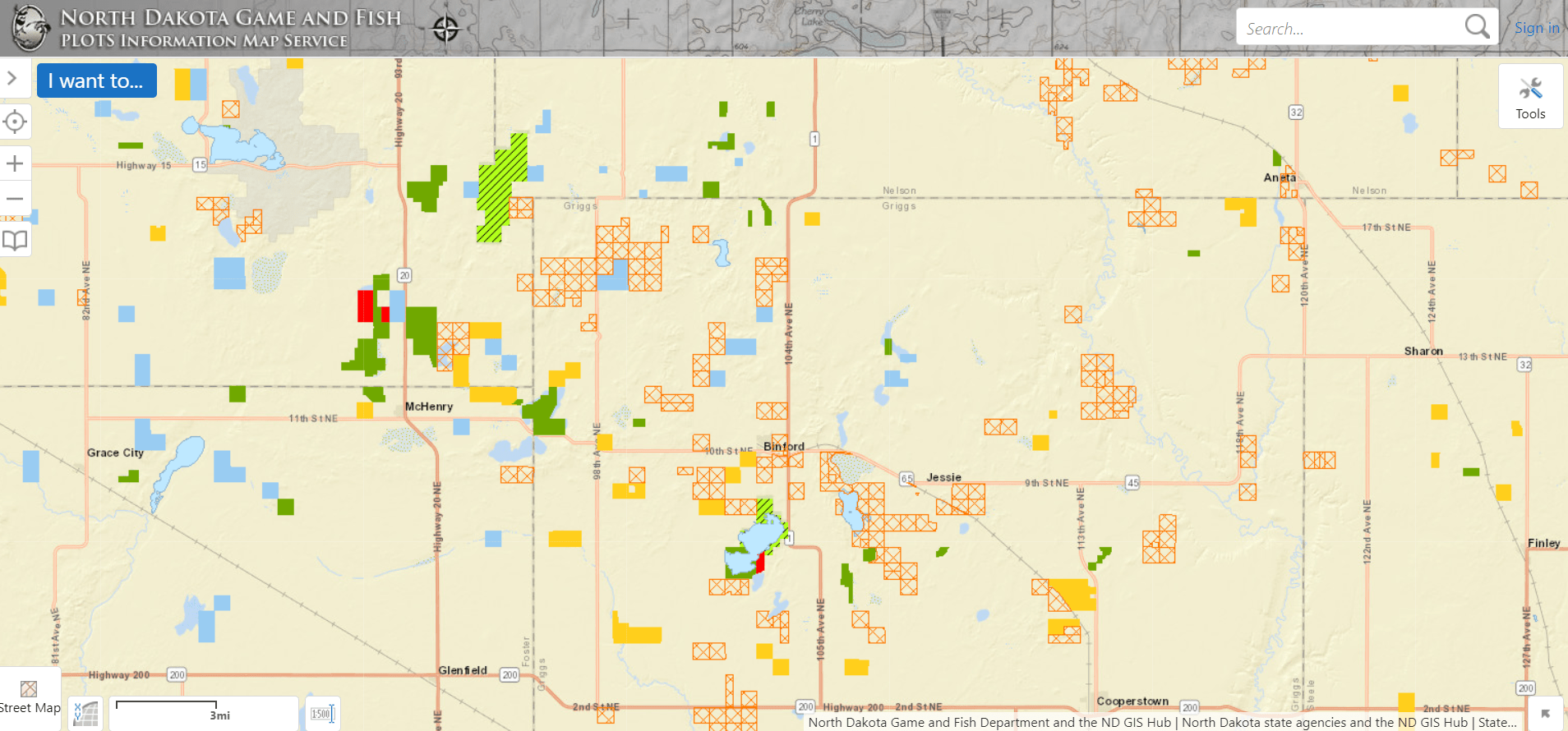
A screen print of the NDG&F PLOTS map program shows crosshatched lands which have been electronically posted under new laws effective Aug. 1, 2021.
By John Bradley
This fall will be a bit different for North Dakota hunters.
Not only will we be dealing with a historic drought, fire restrictions, and fewer wetlands on the landscape, but we will also need to embrace a new system for finding where we can and cannot hunt. Earlier this month, North Dakota’s new electronic posting laws went into effect, right in time for the early Canada goose management season. The 2021 state legislature passed a bill to allow electronic posting of private land, giving landowners another option for managing land access. For hunters taking to the field, it means that we have a new responsibility to check land is designated posted with physical signs or electronically when it comes to hunting private ground. Luckily, the tools available to find where to hunt are simple to use and free to the public.
There are a couple free mapping apps available on your smart phone or computer to find electronically posted land. Both the PLOTS Guide viewer and ArcGIS Explorer app will show electronically posted lands in orange crosshatch. When you click on a land parcel, it will display the individual who posted the land and may include additional contact info like a phone number or email. While looking at the Arc GIS Explorer app, I’ve selected parcels at random and have been pleasantly surprised at how many landowners have voluntarily included a contact phone number on the site. Hopefully this trend continues, allowing more hunters and landowners to connect and secure permission for hunting.
These map applications can be accessed by a computer and others are available as an app on your smart phone. These apps offer a variety of features outside of identifying what land is posted, including who to contact for private land access, hunting districts, PLOTS, WMA and WPA boundaries and the ability to work offline or without cellular service. In talking with the folks at Game & Fish, it appears other apps will jump on this trend and provide the electronically posted land information this fall as well, including the popular Hunt OnX.
Whether from the truck or on foot, all these apps should allow a hunter to see where they are in relationship to posted land, unposted land, or public ground.
There may be a bit of a learning curve for those “low tech” or “no tech” hunters who want to use the app. But for those who prefer paper maps, the online maps from the PLOTS Guide viewer can be printed and used like the traditional paper PLOTS Guide. With the deadline for landowner sign ups already over, one big print job will cover the entire state and should last the entire season.
We as hunters should strive for zero trespassing offenses every fall, but particularly this fall when all eyes will be on the new electronic posting system. Is this a perfect system for hunters? Of course not, but if it’s embraced by landowners and respected by hunters, it should decrease tensions between hunters and landowners and prevent all lands from being automatically posted closed to public hunting in the future, and that is something that we should all get behind.
John Bradley is a Dakota Edge Outdoors contributing writer and the Executive Director of the North Dakota Wildlife Federation.