JAMESTOWN, N.D. (NewsDakota.com) – It may be halfway through September, but the threat of severe storms is still possible for North Dakota.
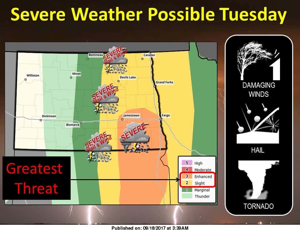
The Bismarck National Weather Service reports that a majority of North Dakota will see storms beginning Tuesday and continuing through the day with the greatest threat striking the Southeast portion of the state. Meteorologist Todd Hamilton says the unfavorable weather will be due to an incoming cold front.
Hamilton says while storms will be possible through much of the state, the main focus will be areas including Jamestown, Valley City, Oakes and many other parts of the James & Red River Valley.
The system will have increased chances to bring high winds, hail and potential for a tornado.
Stay tuned to your local Ingstad Family Media station for updates on weather.