
Photo: National Weather Service in Bismarck
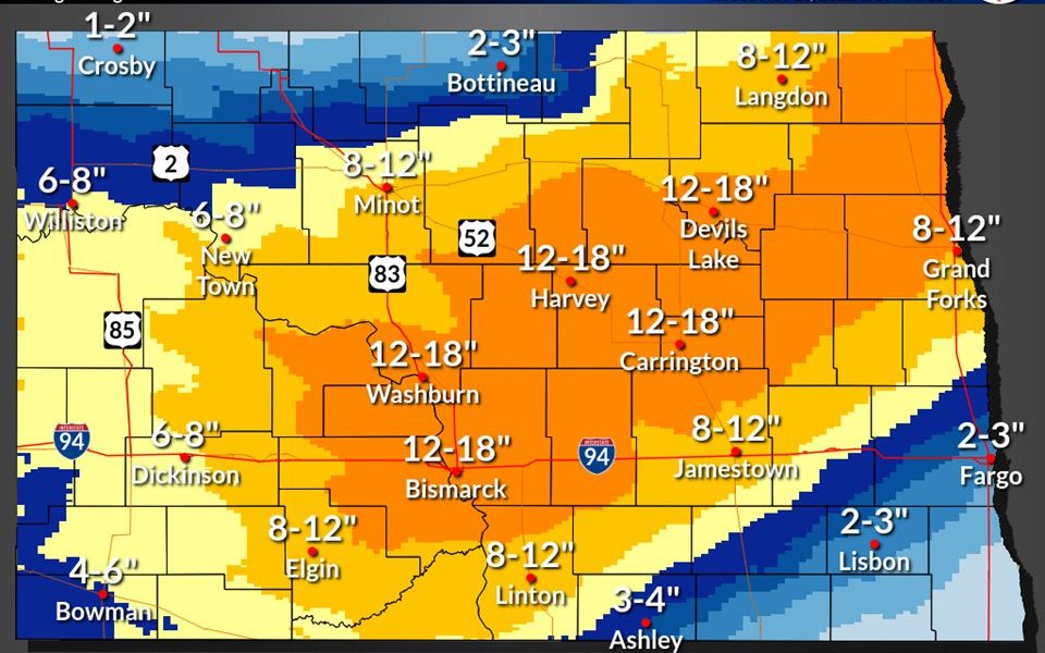
JAMESTOWN, N.D. (NewsDakota.com) – As the first significant amount of snowfall hits North Dakota today, forecasters are still unsure where the most impact will be at this time.
Significant snowfall is expected through Thursday into Friday morning. The National Weather Service reports gusty winds will result in blowing snow, bringing blizzard conditions to much of central and portions of southwest North Dakota. Freezing rain remains likely over portions of the southern James River Valley before switching to all snow by mid-day, possibly leading to power outages. Portions of LaMoure and Dickey Counties could see ice accumulations up to 0.25″.
Mick Kjar is the meteorologist for the Ag Central Radio Network.
If you have a weather announcement, postponement, or cancellation, email weather@newsdakota.com to have it on our website and for our DJ’s to read on-air.