
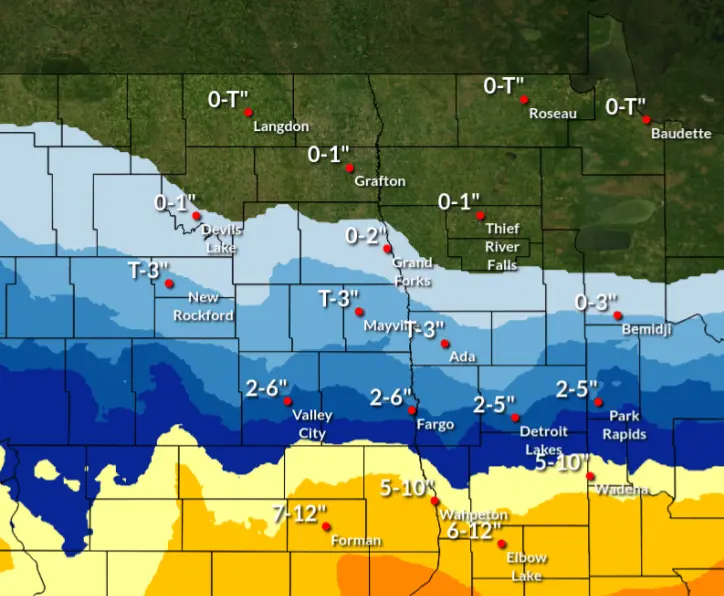
GRAND FORKS, N.D. (NewsDakota.com) – A major winter storm will impact the Northern Plains this weekend. Accumulating snow will begin Saturday afternoon, lasting through Sunday. Total snowfall accumulations will be 4-6 inches, with localized totals approaching a foot of snow mainly along the North Dakota/South Dakota state line.
Snow likely, mainly after 4pm or 5pm. Patchy blowing snow after 3pm. Mostly cloudy, with a high near 29. East wind 7 to 12 mph increasing to 13 to 18 mph in the afternoon. Winds could gust as high as 28 mph. Chance of precipitation is 60%.
Blowing snow will increase Sunday. Widespread blowing snow will periodically reduce visibility to whiteout in the southern Red River Valley.
Freezing rain and accumulating snow may bring travel impacts Tuesday into Wednesday. The probability for advisory level impacts is 40%.